Visibility maps
Moon altitude and elongation at sunset, gridded across Indonesia or the whole world. Hover to read values, click any point for the full breakdown.
Software · Desktop · macOS & Windows
Hilal Ephemeris computes the Moon's altitude and elongation at sunset across the entire planet, then draws the MABIMS and KHGT criteria right onto the map. Precise positions, straight from NASA JPL.
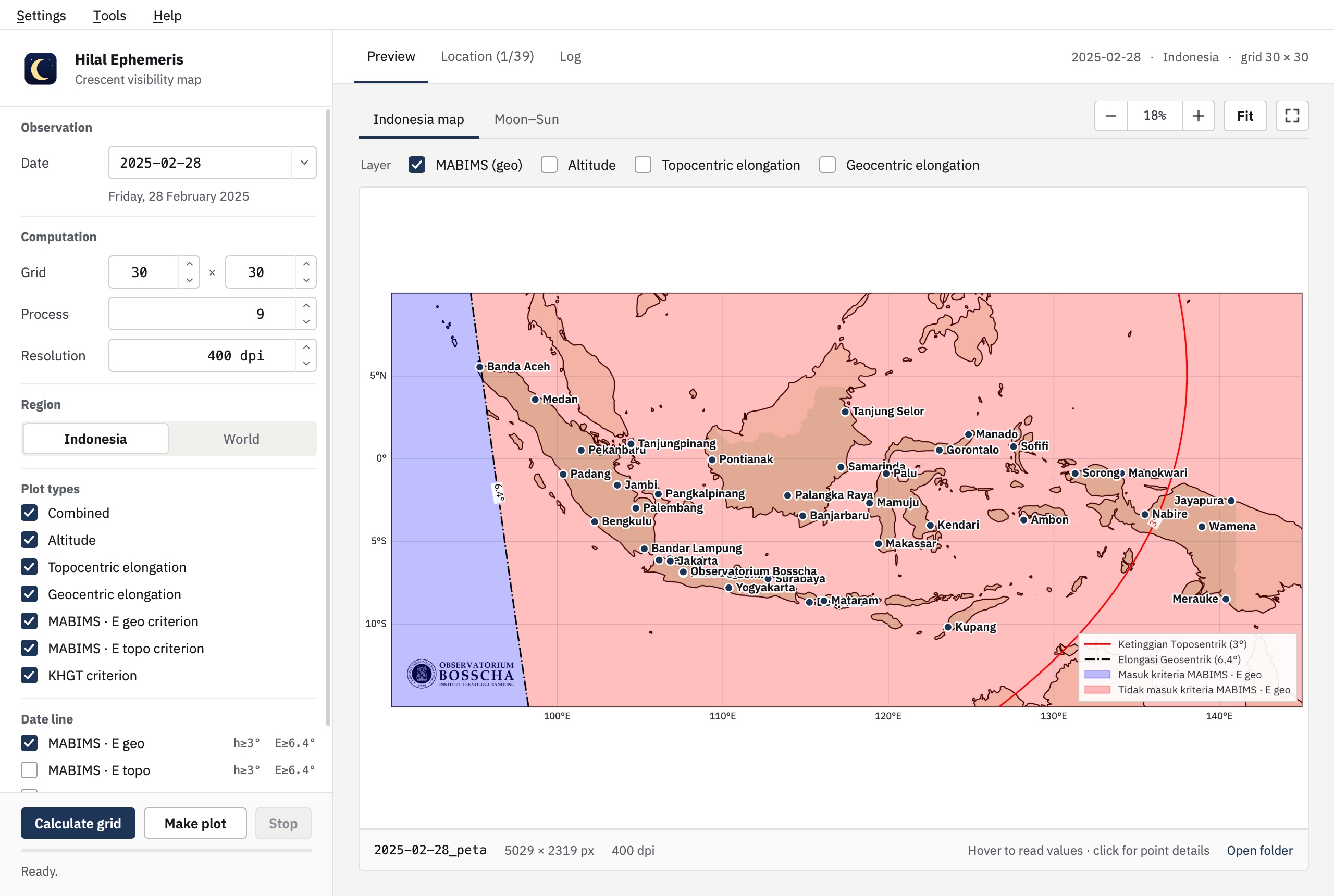
Moon altitude and elongation at sunset, gridded across Indonesia or the whole world. Hover to read values, click any point for the full breakdown.
Criterion lines and shaded regions drawn straight onto the map. Toggle MABIMS (geocentric or topocentric) and KHGT as layers, with legends included.
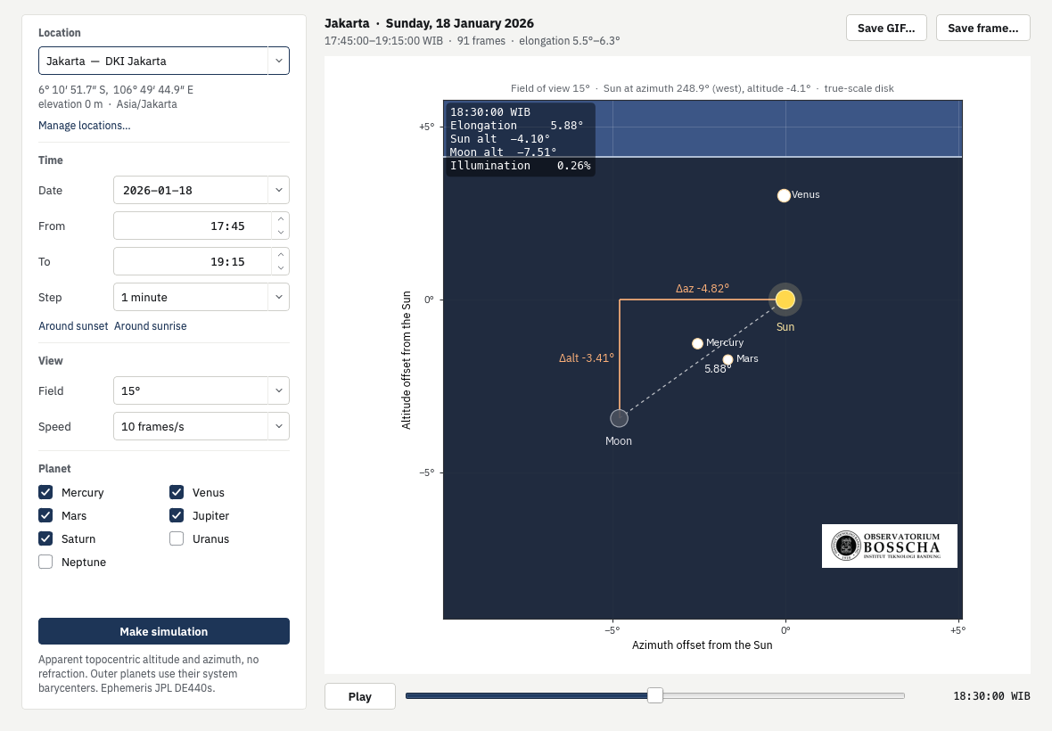
Animate the Moon, Sun and planets in a chosen field of view around sunset, then export it as a GIF.
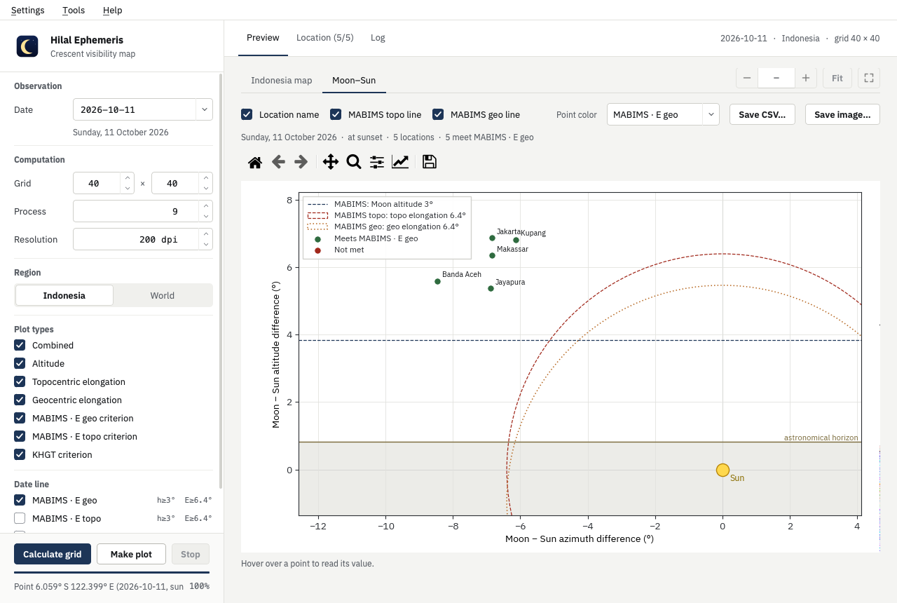
Plot the azimuth and altitude difference between Moon and Sun for every saved location, against the criterion lines.
Switch between JPL ephemerides (DE430 through DE442) from inside the app, with year ranges and sizes listed. Out-of-range dates are refused clearly.
All 38 provincial capitals ship with BIG coordinates. Edit them or add your own; checked locations are computed with every map and saved to CSV.
Sky simulation
Pick a location and a time span. The app animates the Moon, Sun and planets around the setting Sun, with elongation, altitude and illumination in the corner of every frame. Save the result as a GIF for a report or a talk.
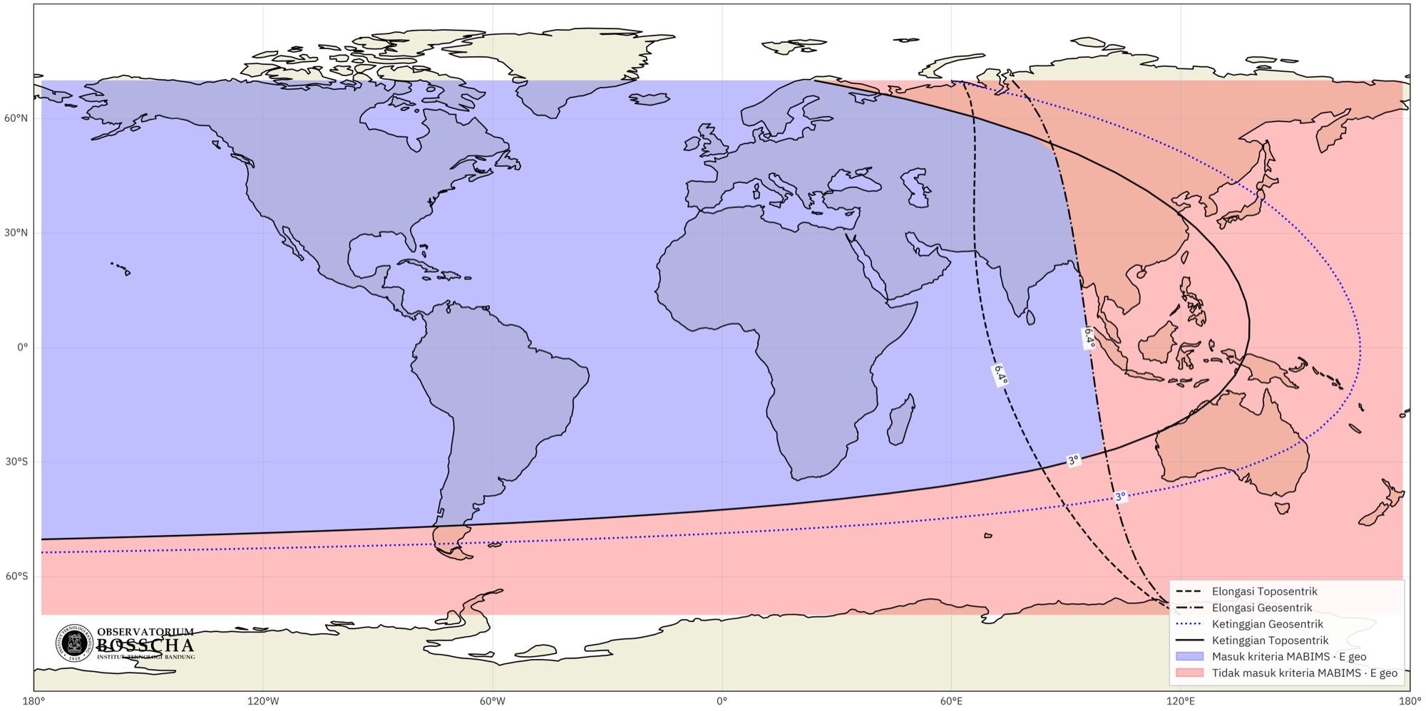
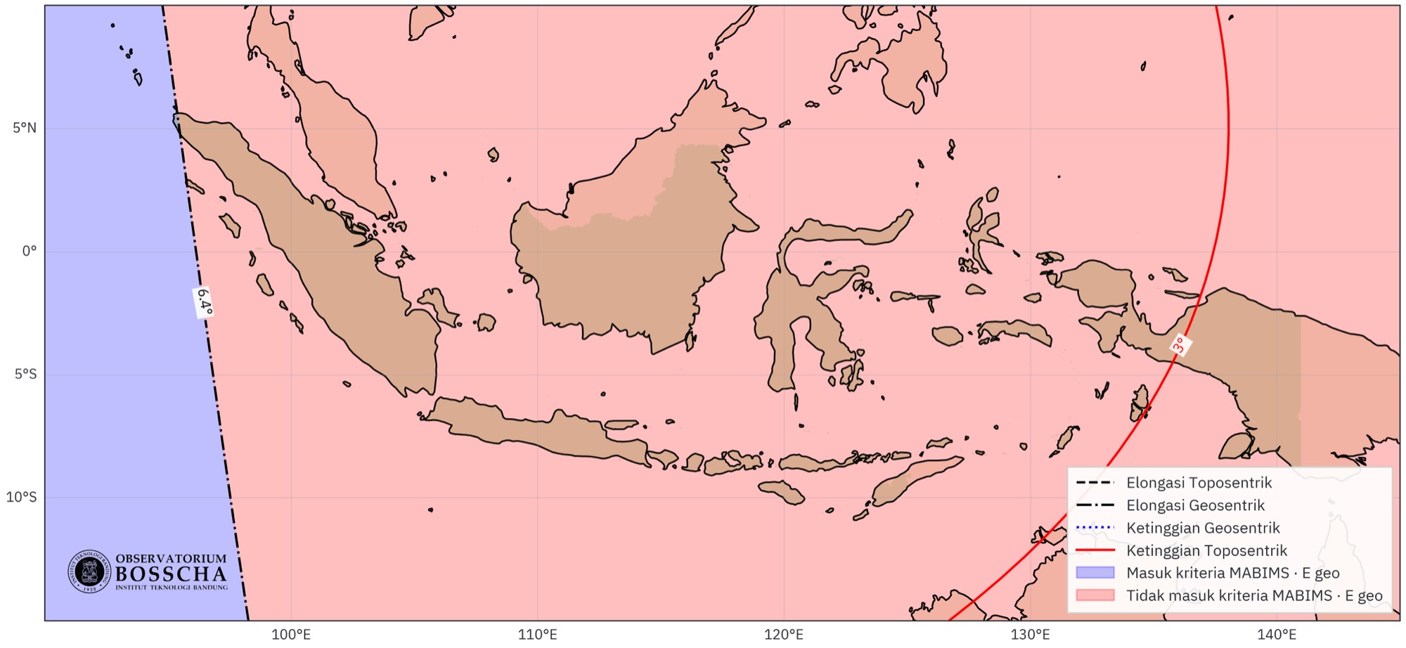
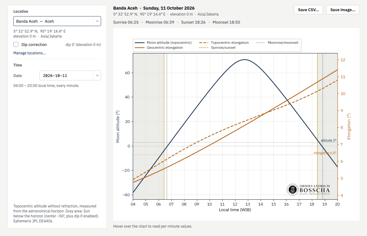
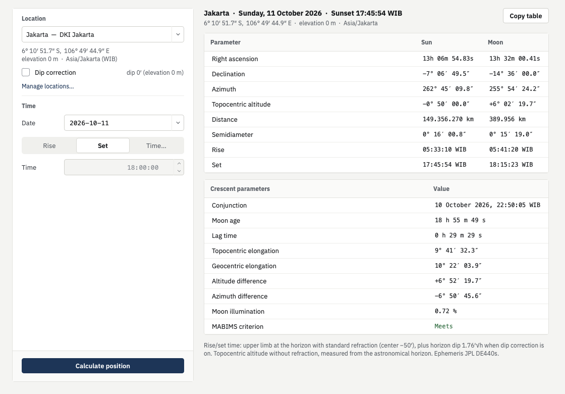
Sun and Moon positions come from Skyfield reading JPL Development Ephemerides published by NAIF. Boundaries use Natural Earth. Apparent topocentric coordinates, with optional dip correction from elevation. Every result is saved as a reusable grid, so re-plotting is instant.

Version 0.0.4, released 6 October 2026. Free to download. What's new
SHA-256 b12bdd2064237738a9cf7125381e0e98cb2f016403b84d8d02e2540f92fc8688SHA-256 7d30af6012853b8532e4807e5e07fc73507375f371a68baa0df4498c4608af3d
Support the project
Hilal Ephemeris is free, and it is built in my precious spare time: evenings and weekends between work and nights at the telescope. If it helps your hilal observations, your support would mean a great deal and keeps new features and kernels coming.
Support on SaweriaThe app is not notarised by Apple, so macOS may say it cannot verify the developer. Unzip it, then right-click app_ephemeris and choose Open, and confirm. You only need to do this once. Or, in Terminal:
xattr -dr com.apple.quarantine app_ephemeris.app
To check the download, compare its SHA-256 with the value above:shasum -a 256 Ephemeris-0.0.4-macos-arm64.zip
The installer is not code-signed, so Windows SmartScreen may show “Windows protected your PC”. Choose More info, then Run anyway. The installer does not need administrator rights. To check the download, compare its SHA-256 with the value above:Get-FileHash Ephemeris-Setup-0.0.4.exe